On-Demand Aerial Data
At Unprecedented Scale
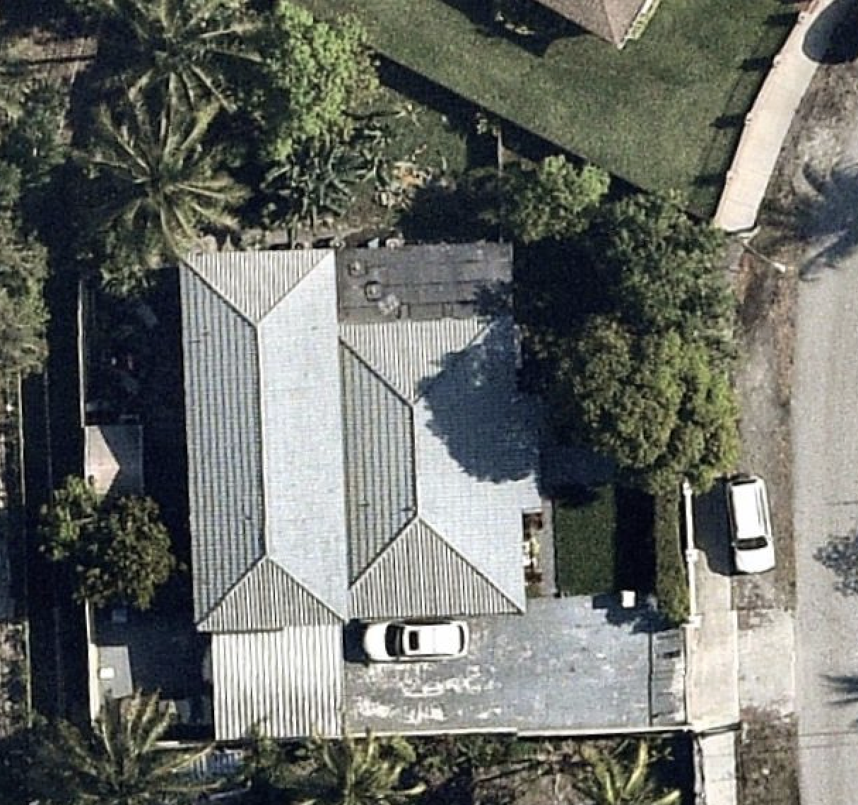
SkyVault provides access to the world's most advanced autonomous drone fleet for property imaging. Our remote operations and scalable pilot network deliver uniform, high-resolution data for millions of properties.
A New Class of Aerial Intelligence
Traditional aerial imagery forces a compromise: the speed of planes with poor resolution, or the detail of drones without scalability. Drodat SkyVault delivers both—neighborhood-wide scans with unmatched clarity.
| Feature | Individual Drones | High-Altitude Planes | Drodat SkyVault |
|---|---|---|---|
| Image Clarity for Damage | High | Low | Exceptional |
| Cost per Property | High | Moderate | Low |
| Scalability (Neighborhood Scans) | |||
| Intrusiveness to Homeowner | High | None | None |
| Fine-Detail Analysis (Wear vs. Storm) | Excellent | Poor | Excellent |
| Lead Generation Precision | Impractical at Scale | Low | High & Scalable |
How SkyVault Works
From Raw Pixels to Profitable Decisions.
Our streamlined, four-step process transforms high-altitude aerial scans into the actionable business intelligence you need to outperform the competition.
Advanced Aerial Scans
We deploy our proprietary fleet to scan entire neighborhoods at high altitude, ensuring zero disturbance to homeowners below.
Hyper-Resolution Capture
Our state-of-the-art payload captures imagery with unprecedented detail, revealing fine-print damage that other methods miss.
AI-Powered Analysis
Our machine learning models analyze the raw imagery, identifying and flagging key data points like material degradation, storm damage, and property changes.
Actionable Insights Delivered
Access the processed data through our platform to make faster, more profitable decisions—from surgical lead generation to precise claims validation.
Solutions For Your Industry
Delivering targeted value where it matters most, SkyVault provides specialized tools for insurance carriers and roofing contractors to excel.
Ground-Truth from the Sky
For Insurance Carriers
Mitigate risk and eliminate fraudulent claims. Our hyper-resolution imagery provides undeniable evidence of a property's condition, allowing you to easily distinguish pre-existing wear and tear from acute storm damage.

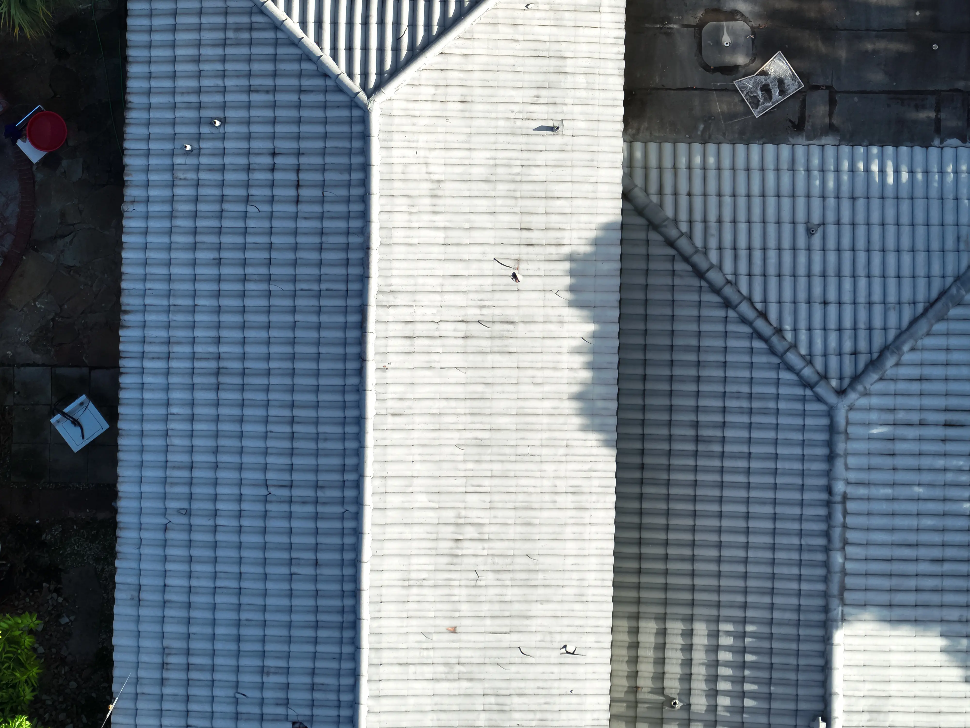
A New Standard in Image Quality
See in Unprecedented Detail.
Experience the power of our 4K drone operations. When every detail matters for an inspection, valuation, or claim, our ultra-HD imagery provides the ground truth you need to make confident decisions.
Scale Without Compromise
Quality, Speed, and Scale. Pick Three.
Existing aerial imagery forces a choice: the detail of manual drones, which can't scale, or the speed of airplanes, which lack quality. SkyVault is the first platform to deliver all three: unmatched image clarity, on-demand deployment, and enterprise scale.
Manual Drones
- High-Resolution Imagery
- Slow Deployment
- Not Scalable for Regions
Manned Aircraft
- Low-Resolution Imagery
- Region-Wide Scalability
- Infrequent, Scheduled Flights
Drodat SkyVault
- High-Resolution Imagery
- Region-Wide Scalability
- On-Demand Deployment
Frequently Asked Questions
Ready to transform your workflow?
Join thousands of property professionals who've streamlined their operations, reduced manual work, and accelerated their business with Drodat's intelligent platform.